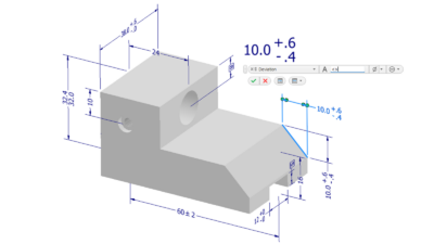
Capturing 2D and 3D representations of locations is a crucial step in AEC projects to inform the design work.
An existing conditions survey is one of the key elements needed to design a new building, infrastructure improvement or land development project. It identifies the natural features of the project area, including elevations, drainage patterns and vegetation, as well as existing facilities such as buildings, roads, utilities and other information. Some AEC professionals collectively call this a topographic survey, while others consider topographic surveys to be those focused on natural features.
Regardless of terminology, an accurate depiction of existing conditions is crucial for designing new projects. The information helps architects and engineers design facilities that fit into the surrounding area and meet the needs of people using the facilities.
Information included in existing conditions surveys
An existing conditions survey establishes locations (typically 3D, but sometimes 2D) of key features related to the project and other related information, including the following:
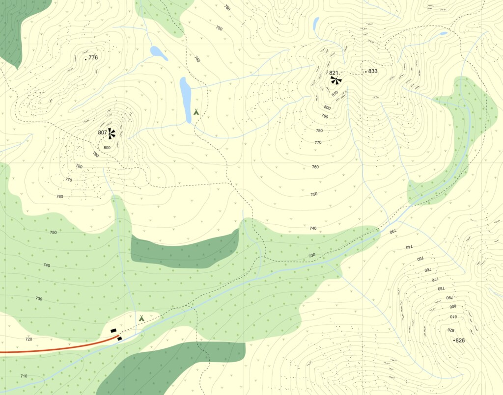
- The overall shape and elevation of the land in the area of interest — often referred to as the topography. This might include 3D point data identifying high points, low points and other key locations to represent the terrain, along with contours identifying areas of equal elevation.
- Streets, roads, driveways, sidewalks and other paved or graded areas. This typically includes 3D data defining the elevations of key facilities to which the new facility might connect.
- Permanent structures such as buildings, walls, bridges, fences, and other structures, with 3D data identifying building floor elevations, wall and bridge surfaces and other key elements.
- Railroads and other transportation facilities that may be located near the project.
- Lakes, rivers, streams and other water features on or near the area of interest. Wetland limits may be identified if delineated by qualified experts. Floodplain information, if available and applicable, may be added based on records.
- Trees and other vegetation. In some cases, tree sizes are identified by trunk diameter.
- Observable evidence of wells, soil borings, landfills and other subsurface features.
- Above-ground utilities, including power poles, light poles, overhead wires, guy wires, anchors and vaults.
- Underground utilities, including water, sanitary sewer, gas, electric, cable television and communications. Information may include surface features of underground utilities, such as valves, fire hydrants, meters, manholes and access structures, as well as marking information from the utilities or utility location services. In some cases, subsurface pipe elevations are obtained via access structures.
- Drainage facilities, such as storm sewers, combined sewers, culverts, access structures and other components. 3D information indicating sizes, flow directions, and elevations of pipes or culverts is typically needed to design new facilities. Pipe materials are also often identified during the survey.
- Visible rock formations or other geological features.
- Benchmarks used to conduct the survey.
- Boundary information for the property of interest. This might include physical markers such as property corners located in the survey, as well as approximate information collected from records showing property lines, rights-of-way and easements. An existing conditions survey should not be confused with other types of surveys, such as boundary surveys or title surveys, which must comply with certain standards.
- Other items as needed for particular projects.
The level of detail may vary significantly depending on the project. In some cases, information from other sources may be included with existing conditions surveys, though this requires additional attention to maintain consistent accuracy. For example, if information from a regional topographic map is being considered, it may not have the same level of accuracy as the project survey, or it may be based on a different survey datum.

How is survey information collected in the field?
Information may be collected in several different ways, as discussed in a separate article:
- LiDAR (light detection and ranging, or sometimes laser imaging, detection and ranging): Ground-based or aircraft-mounted lasers take multiple measurements encompassing the area of interest, establishing large point clouds of data.
- Laser scanning: Ground-based laser scanners focus on specific buildings, mechanical systems or other objects to build detailed 3D models of those specific items.
- Photogrammetry: Aerial photography and stereoplotters are used to analyze two or more photographic images taken from different positions to determine 3D coordinates of select points and create topographic maps.
- GNSS (global navigation satellite system): Satellite data is used to provide a wide range of geospatial information. The U.S.-operated global positioning system (GPS) is one of many GNSSs in the world.
- Conventional survey equipment: Tape measures and instruments such as theodolites, levels and total stations are used to establish locations at key points.
How do existing conditions surveys inform design work?
Existing conditions surveys often serve as the starting point for design work, providing a base map for designers in establishing initial design concepts and advancing designs into construction. Some examples include:
- New buildings: Surveys help determine the location and sizing of new buildings of various types, such as residential, commercial, industrial, government and healthcare. New structures typically need to be located within certain boundaries and sited at elevations that enable appropriate access, provide adequate drainage and meet applicable building codes. Building designs also need to consider locations of natural features, existing utilities and other improvements in the area.
- Building renovations or additions: As with new building projects, surveys for renovations or additions identify applicable key features, particularly existing structure locations and other factors that influence the design of additions or improvements.
- Infrastructure projects: Roads, bridges, utilities and other infrastructure projects require detailed information on existing conditions to enable proper design and integration of the new facilities. Facilities need to tie into surrounding property and consider topography for proper drainage and operation of gravity systems such as sewers. Topography may also determine locations of pipes and underground facilities to meet certain depth or cover requirements.
- Land development projects: Surveys establish overall site topography and determine potential subdivision of property into smaller parcels or lots, as well as potential building pad locations.
- Preservation projects: Surveys of historic buildings and sites provide documentation to guide restoration and maintenance efforts.
- Facility management: Surveys help facility managers maintain accurate records of facilities, guiding ongoing maintenance, repairs and future upgrades.
- Real estate: Surveys provide key information for assessing property conditions before completing transactions.

The importance of existing condition surveys cannot be overstated. An inaccurate or incomplete survey can lead to later issues, such as location conflicts with existing structures or utilities. A thorough, accurate survey can guide the project throughout all stages of design and construction and also provide valuable information for conducting later surveys, such as construction surveys and as-built surveys.


